TF0746 : Cogglesford Watermill
taken 16 years ago, near to Sleaford, Lincolnshire, England
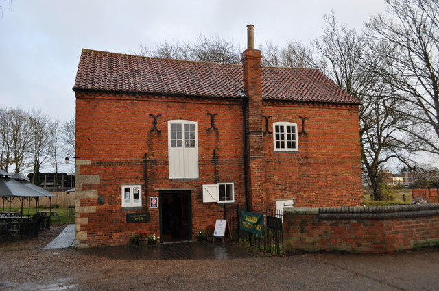
This little watermill, now run by a trust is the last working watermill in Lincolnshire (lots more windmills). There has been a mill here on the river Slea since Anglo Saxon times, the Anglo Saxon one would have been a lot simpler and probably used a turbine Roman like mechanism. This example was one of 18 noted to be on the Slea when the Domesday book (Norman) was written in 1086. Later in medieval times under the feudal system peasants made up most of the population. Some 90% of medieval folk lived on the land. The local landlord owned the mill and charged a toll, through time the word Sheriff (old Anglo Saxon and Norman, Reeve meaning a high up man working for the Lord and Shire meaning the local area) has been used to describe this, now the mill is the oldest and only Sheriff mill left.
In the 1770s the mill was modernised (most of the brick structure we see) with two waterwheels plus four stones. As this was the only flour mill left in the area trade was good until the Boston, Sleaford and Midland Counties Railway arrived in June 1857. This meant the local Sleaford navigation got a drop in trade, the decline had started. A steam engine was brought in (not there any more) but the mill went bust in 1882.
However it has now been restored to working order and milling most days. At the time of my visit, November 2010 the milling is done by electric due to the water wheel axle failing, a new one is being made.


- Grid Square
- TF0746, 106 images (more nearby 🔍)
- Photographer
- Ashley Dace (more nearby)
- Date Taken
- Sunday, 21 November, 2010 (more nearby)
- Submitted
- Sunday, 21 November, 2010
- Subject Location
-
OSGB36:
 TF 074 461
[100m precision]
WGS84: 53:0.0866N 0:23.9907W - Camera Location
-
OSGB36:
TF 074 461
- View Direction
- EAST (about 90 degrees)


