2006
SS9038 : The last section of Long Lane before Luckwell Bridge
taken 18 years ago, near to Luckwell Bridge, Somerset, England
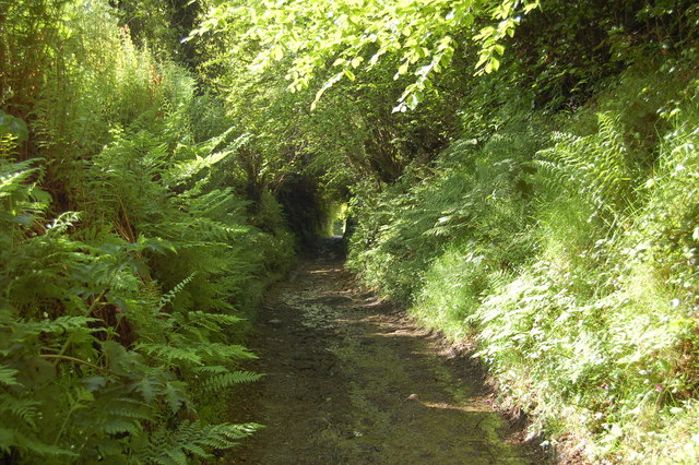
The last section of Long Lane before Luckwell Bridge
This track was part of an important packhorse trade route mainly between Porlock on the coast and towns such as Dulverton. At the bottom of this lane was the Red Lion Inn. A stone on the side of the extended house reads W.B. 1765
 Map © Crown Copyright")
TIP: Click the map for more Large scale mapping
- Grid Square
- SS9038, 30 images (more nearby 🔍)
- Photographer
- Ian Wigley (more nearby)
- Date Taken
- Tuesday, 23 May, 2006 (more nearby)
- Submitted
- Friday, 11 August, 2006
- Subject Location
-
OSGB36:
 SS 906 388 [100m precision]
WGS84: 51:8.2791N 3:33.9058W - Camera Location
-
OSGB36: SS 905 388
- View Direction
- South-southeast (about 157 degrees)