2006
ST5038 : Glastonbury abbey gardens with Chalice Hill beyond
taken 18 years ago, near to Glastonbury, Somerset, England
Glastonbury abbey gardens with Chalice Hill beyond
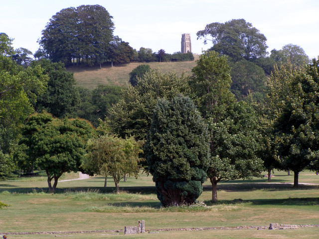
The parkland within Glastonbury Abbey precinct is planted with many different species of tree, and there is a map with key to identify all the trees here on a wall near the Abbey museum building. From this viewpoint on the ruins next to the Abbots Kitchen, St Michael's tower on the top of Glastonbury Tor appears to rest on top of Chalice Hill. There has been some (unfounded) speculation that the original church (the "vestusta ecclesia") was sited on this spot to satisfy some line-of-sight from the summit of the Tor across the summit of Chalice Hill.
 Map © Crown Copyright")
TIP: Click the map for more Large scale mapping
- Grid Square
- ST5038, 289 images (more nearby 🔍)
- Photographer
- Jim Champion (more nearby)
- Date Taken
- Tuesday, 8 August, 2006 (more nearby)
- Submitted
- Friday, 11 August, 2006
- Subject Location
-
OSGB36:
 ST 500 387 [100m precision]
WGS84: 51:8.7221N 2:42.9695W - Camera Location
-
OSGB36: ST 4997 3878
- View Direction
- South-southeast (about 157 degrees)