2010

NZ4057 : National Glass Centre, Monkwearmouth

taken 13 years ago, near to Roker, Sunderland, England
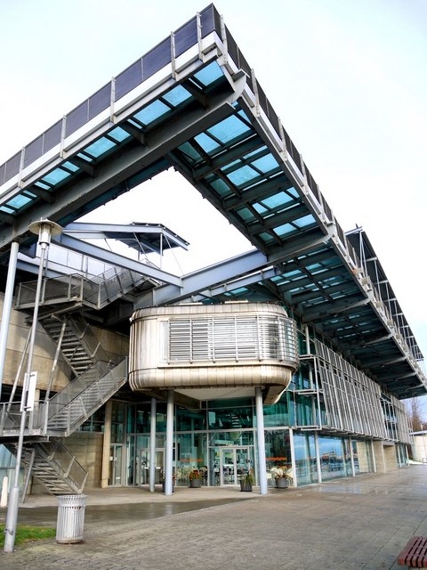
National Glass Centre, Monkwearmouth
National Glass Centre

The National Glass Centre LinkExternal link was officially opened by HRH Prince Charles in October 1998. The project was awarded the first major Lottery funding in the North East and was the first Lottery-funded building to be constructed. The building is situated on the site of the former J.L.Thompson ship yard, close to St Peter's Church where glass making in England was established in 674AD when glaziers from France brought the skill to the monastic community of Wearmouth LinkExternal link

St Peter's Riverside

A redevelopment of the old Sunderland Harbour area on the north bank at the mouth of the River Wear. This was once a industrial and shipbuilding area before dereliction and redevelopment.
There are some old photos here
NZ4057 : Ships on the River Wear at Sunderland
NZ4058 : Armstrong Addison & Co Ltd, Pier View, North Dock
NZ4058 : Armstrong, Addison & Co Ltd

Case study from the Commission for Architecture and the Built Environment (CABE): LinkExternal link
Helix Arts St Peter's Riverside Sculpture Project: LinkExternal link
Public Art Walks in Tyne & Wear: LinkExternal link


Creative Commons Licence [Some Rights Reserved]   © Copyright Andrew Curtis and licensed for reuse under this Creative Commons Licence.
Category: Heritage centre
This photo is linked from: Automatic Clusters: · National Glass Centre [58] · Monkwearmouth [27] Title Clusters: · National Glass Centre, Monkwearmouth [3] ·
1:50,000 Modern Day Landranger(TM) Map © Crown Copyright
+
+
1:50,000 Modern Day Landranger(TM) Map © Crown Copyright
TIP: Click the map for more Large scale mapping
Grid Square
NZ4057, 292 images   (more nearby 🔍)
Photographer
Andrew Curtis   (more nearby)
Date Taken
Friday, 10 December, 2010   (more nearby)
Submitted
Saturday, 11 December, 2010
Subject Location
OSGB36: geotagged! NZ 4043 5772 [10m precision]
WGS84: 54:54.7535N 1:22.2531W
Camera Location
OSGB36: geotagged! NZ 4043 5767
View Direction
NORTH (about 0 degrees)
Clickable map
+
NW N NE
W Go E
SW S SE
Image classification(about): Geograph
This page has been viewed about 133 times
You are not logged in login | register