NS3878 : Back Street, Renton
taken 13 years ago, near to Renton, West Dunbartonshire, Scotland
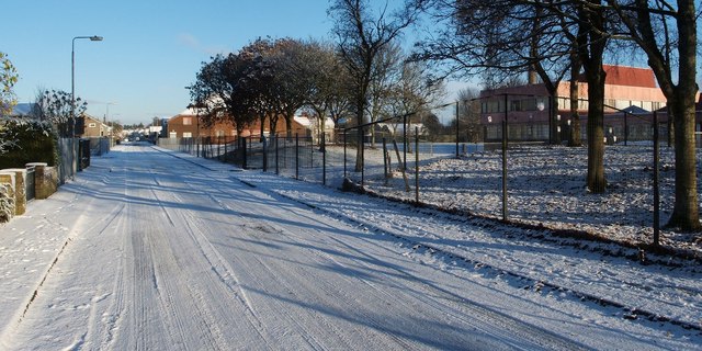
The first turning on the left leads into NS3878 : Carman Industrial Estate.
For a view along the same section of the street, but in the opposite direction, see NS3878 : Back Street, Renton. See also NS3878 : Back Street Renton, which was taken from a point further north along the street, looking in the opposite direction.
A remnant of an early school stands at the northwestern corner of the grounds: for an earlier generation, that red sandstone building was itself the local high school: at that time, its ground floor was used for Gym and Woodwork, while the upper floor was for Science, History, Domestic Science, Geography, and English.
The school building that opened nearby in 1975 had classrooms for Primary 1 to Primary 3 at the single-storey southern end, those for Primary 4 to Primary 7 at the two-storey northern end, and a gym hall / dining hall in the middle. At that time, the much earlier red sandstone building came to be known colloquially as the Annexe.
Early in 2020, work began on the project of replacing the 1975 school building. The new building was completed and came into use in October 2021. It has three stories, and it was built on the site of the playing field of the old (1975) building.
When the new (2021) building was complete, the old (1975) one would be demolished, and its site remodelled to provide a sports pitch and playground for the new building. The overall boundary of the grounds thus remained unchanged, though the positions of the school building and the sports pitch had been swapped around.
By the end of January 2022, the standing structures of the 1975 building had been demolished, though the resulting rubble was yet to be cleared away. By mid-2022, the new playing field built on that same location was complete, although landscaping and related works continued nearby.
The Smollett Monument (a tall column erected in 1774, and still standing in its original position) is on the pavement just outside the eastern boundary of the school grounds, as is a War Memorial that was moved there from opposite Wylie Park Link often locally called Tontine Park. An old drinking fountain Link used to stand outside the school, but it was moved elsewhere.
 Map © Crown Copyright")
- Grid Square
- NS3878, 296 images (more nearby 🔍)
- Photographer
- Lairich Rig (more nearby)
- Date Taken
- Thursday, 11 November, 2010 (more nearby)
- Submitted
- Saturday, 11 December, 2010
- Subject Location
-
OSGB36:
 NS 3875 7822 [10m precision]
WGS84: 55:58.1891N 4:35.1170W - Camera Location
-
OSGB36: NS 3875 7813
- View Direction
- NORTH (about 0 degrees)