2006
J0948 : Old railway station at Laurencetown (2006)
taken 18 years ago, near to Lawrencetown, Co Down, Northern Ireland
Old railway station at Laurencetown (2006)
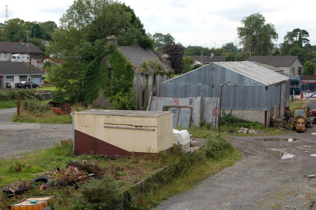
The GNR(I) line from Banbridge to Scarva closed in 1955. Laurencetown was the principal station on the line. This is what remains 51 years after closure (looking towards Scarva). The station is the ivy-covered building.
J0948 : Former Laurencetown station (2013) shows the same view in October 2013.
J0948 : Former Laurencetown station (2013) shows the same view in October 2013.
Loading map... (JavaScript required)
- Grid Square
- J0948, 8 images (more nearby 🔍)
- Photographer
- Albert Bridge (more nearby)
- Date Taken
- Wednesday, 16 August, 2006 (more nearby)
- Submitted
- Wednesday, 16 August, 2006
- Subject Location
-
Irish:
 J 097 489 [100m precision]
WGS84: 54:22.6529N 6:18.6694W - Camera Location
-
Irish: J 098 490
- View Direction
- West-southwest (about 247 degrees)