TQ5136 : National Cycle Network Milepost, route 21
taken 13 years ago, near to Groombridge, East Sussex, England
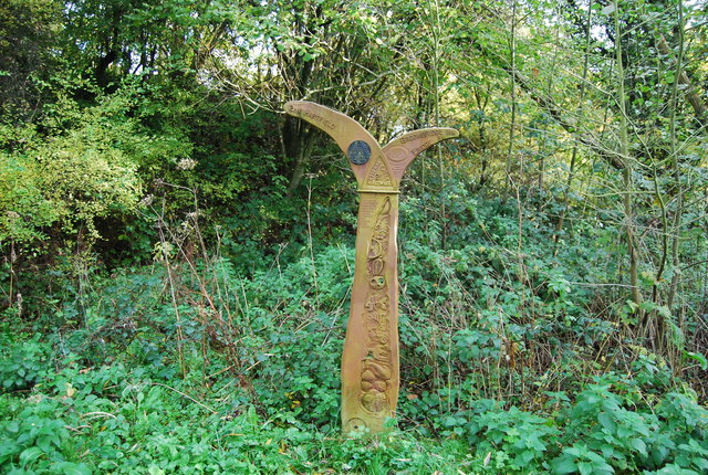
1000 Millennium cast iron mileposts were funded by the Royal Bank of Scotland to mark the creation of the National Cycle Network, and found along the cycles routes through the UK.
There are four different types of posts, "Fossil Tree" by John Mills, "The Cockerel" by Iain McColl, "Rowe Type" by Andrew Rowe, and "Tracks" by David Dudgeon. The four artists are from each country of the UK though all posts can be found in all four countries.
Read the National Cycle Network article Link
Route 21 of The National Cycle Network runs south from Greenwich out of London through Lewisham (the Waterlink Way) to Crawley, and then via East Grinstead and Eridge to Heathfield and Eastbourne, a distance of 95 miles.
The section between Groombridge and East Grinstead follows the Forest Way. Link
See Linkfor a map of the route.
 Map © Crown Copyright")
- Grid Square
- TQ5136, 97 images (more nearby 🔍)
- Photographer
- N Chadwick (more nearby)
- Date Taken
- Monday, 1 November, 2010 (more nearby)
- Submitted
- Thursday, 23 December, 2010
- Subject Location
-
OSGB36:
 TQ 514 369 [100m precision]
WGS84: 51:6.7054N 0:9.7069E - Camera Location
-
OSGB36: TQ 514 369
- View Direction
- North-northeast (about 22 degrees)