2006
SH6226 : A marshy field at Cwmnantcol
taken 18 years ago, 3 km from Pentre Gwynfryn, Gwynedd, Wales
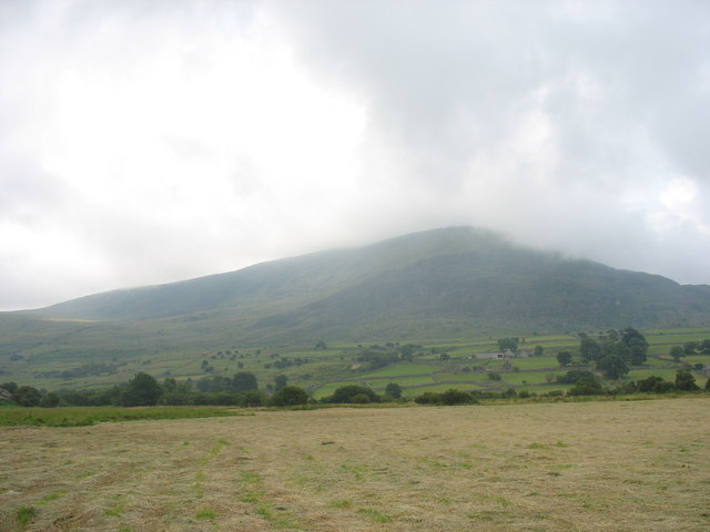
A marshy field at Cwmnantcol
This field on the valley floor, although drained by a series of ditches, was still wet underfoot even though it was the middle of the July, 2005 heatwave. Fortunately, the farmer has cut the reeds a day or two before, which made it easier to follow the sketchily way-marked path. The line of trees ahead marks the course of Afon Cwmnantcol. The farmhouses, some of them quite large, are on the slope above the river's flood plain. The col between Moelfre and Moelyblithcwm is apparent on the left, while the far peak is Diffwys.
 Map © Crown Copyright")
TIP: Click the map for more Large scale mapping
- Grid Square
- SH6226, 11 images (more nearby 🔍)
- Photographer
- Eric Jones (more nearby)
- Date Taken
- Friday, 21 July, 2006 (more nearby)
- Submitted
- Thursday, 17 August, 2006
- Subject Location
-
OSGB36:
 SH 626 265 [100m precision]
WGS84: 52:49.1085N 4:2.4198W - Camera Location
-
OSGB36: SH 626 268
- View Direction
- SOUTH (about 180 degrees)