2010
SJ8860 : Cutting on the Biddulph Valley Way
taken 13 years ago, near to Hightown, Cheshire East, England
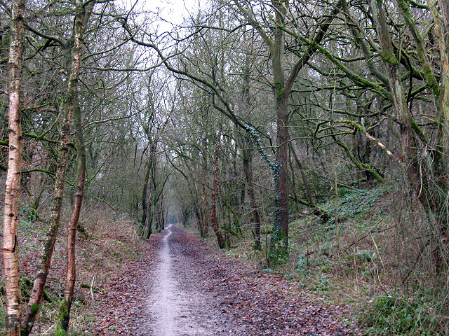
Cutting on the Biddulph Valley Way
This cutting was originally made for the Biddulph Valley Railway (1859 to 1968). It is now a recreational route and the cutting forms part of the Whitemore Local Nature Reserve.
 Map © Crown Copyright")
TIP: Click the map for more Large scale mapping
- Grid Square
- SJ8860, 57 images (more nearby 🔍)
- Photographer
- Stephen Craven (more nearby)
- Date Taken
- Thursday, 30 December, 2010 (more nearby)
- Submitted
- Saturday, 8 January, 2011
- Subject Location
-
OSGB36:
 SJ 885 609 [100m precision]
WGS84: 53:8.7125N 2:10.3853W - Camera Location
-
OSGB36: SJ 885 609
- View Direction
- South-southeast (about 157 degrees)