2011
TL7106 : Springfield Lock, information sign
taken 13 years ago, near to Great Baddow, Essex, England
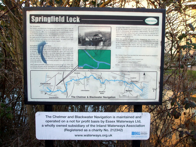
Springfield Lock, information sign
Left full size so that it can be read.
Lots of information and a plan of the Chelmer & Blackwater Navigation.
Lots of information and a plan of the Chelmer & Blackwater Navigation.
 Map © Crown Copyright")
TIP: Click the map for more Large scale mapping
- Grid Square
- TL7106, 97 images (more nearby 🔍)
- Photographer
- terry joyce (more nearby)
- Date Taken
- Friday, 21 January, 2011 (more nearby)
- Submitted
- Tuesday, 25 January, 2011
- Subject Location
-
OSGB36:
 TL 716 063 [100m precision]
WGS84: 51:43.7919N 0:29.0211E - Camera Location
-
OSGB36: TL 716 063
- View Direction
- NORTH (about 0 degrees)