2006
HY6739 : Peedie Sea, Sanday
taken 18 years ago, near to Sanday Airport, Sanday, Orkney Islands, Scotland
Peedie Sea, Sanday
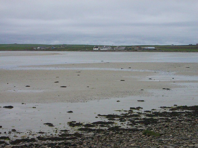
Looking across the Little Sea (or Peedie Sea) as it starts to be refilled by the incoming tide. The houses in the distance are at Silverhall.
"Peedie" is an Orcadian word meaning "small".
"Peedie" is an Orcadian word meaning "small".
 Map © Crown Copyright")
TIP: Click the map for more Large scale mapping
- Grid Square
- HY6739, 24 images (more nearby 🔍)
- Photographer
- Lis Burke (more nearby)
- Date Taken
- Friday, 19 May, 2006 (more nearby)
- Submitted
- Wednesday, 23 August, 2006
- Subject Location
-
OSGB36:
 HY 677 396 [100m precision]
WGS84: 59:14.5040N 2:34.0750W - View Direction
- Northwest (about 315 degrees)