SO9868 : Tardebigge Lock No 51, Worcestershire
taken 14 years ago, near to Tardebigge, Worcestershire, England
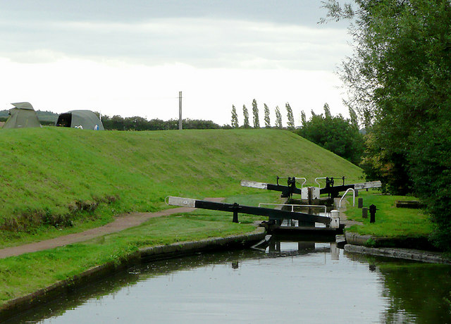
The flight of thirty locks from Stoke Pound to Tardebigge (Birmingham Level) raises the water level by 217 feet (66 metres) in about two miles (3.3 km). These locks are numbered 29 to 58, bottom to top, all of them Grade II listed structures.
In all, between the River Severn at Worcester and the Birmingham level (just under sixteen miles) there are 58 locks, raising the water level by 428 feet (about 157 metres) and five tunnels. This was not the original plan, which involved 76 locks. At one time the engineer John Woodhouse proposed that there be just twelve locks and a series of boat-lifts, but although just one lift was built (at the present Tardebigge Top Lock) this was quite quickly replaced, and the lift idea was replaced with just 58 locks.
Wikipedia has more details: Link
 Map © Crown Copyright")
- Grid Square
- SO9868, 189 images (more nearby 🔍)
- Photographer
- Roger D Kidd (more nearby)
- Date Taken
- Tuesday, 24 August, 2010 (more nearby)
- Submitted
- Thursday, 10 February, 2011
- Subject Location
-
OSGB36:
 SO 984 685 [100m precision]
WGS84: 52:18.8871N 2:1.4769W - Camera Location
-
OSGB36: SO 984 685
- View Direction
- South-southwest (about 202 degrees)