2011
NX2856 : Annabaglish Moss
taken 13 years ago, 3 km from Barlae, Dumfries And Galloway, Scotland
This is 1 of 7 images, with title Annabaglish Moss in this square
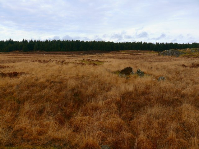
Annabaglish Moss
View north from near to the Moss past Inchmulloch Hill right of picture to the large unnamed forest on the horizon which is next to Darnagie Hill. The ground here is extremely difficult to cross following recent rain storms that have created hundreds of small burns across the moors. Full waterproofs made no difference when I was waist deep in water.
 Map © Crown Copyright")
TIP: Click the map for more Large scale mapping
- Grid Square
- NX2856, 8 images (more nearby 🔍)
- Photographer
- Andy Farrington (more nearby)
- Date Taken
- Sunday, 13 February, 2011 (more nearby)
- Submitted
- Sunday, 13 February, 2011
- Subject Location
-
OSGB36:
 NX 283 569 [100m precision]
WGS84: 54:52.6816N 4:40.6304W - Camera Location
-
OSGB36: NX 283 569
- View Direction
- NORTH (about 0 degrees)