2011
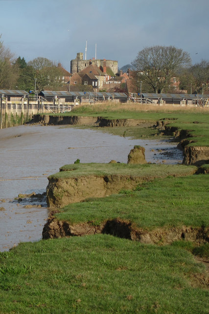
TQ9220 : Mud Banks on the River Rother
taken 13 years ago, near to Rye, East Sussex, England
This is 1 of 4 images, with title Mud Banks on the River Rother in this square
Mud Banks on the River Rother
Jagged edge of erosion alongside the Rother. TQ9220 : Rye Landgate seen in distance.
River Rother
The River Rother runs for 35 miles from Rotherfield, East Sussex, entering Kent after Bodiam where it follows the county border to Wittersham, where it rejoins East Sussex to the mouth at Rye.
There are two other River Rothers in Yorkshire and in Hampshire to West Sussex.
 Map © Crown Copyright")
TIP: Click the map for more Large scale mapping
- Grid Square
- TQ9220, 1467 images (more nearby 🔍)
- Photographer
- Oast House Archive (more nearby)
- Date Taken
- Monday, 4 April, 2011 (more nearby)
- Submitted
- Monday, 11 April, 2011
- Subject Location
-
OSGB36:
 TQ 924 204 [100m precision]
WGS84: 50:57.0645N 0:44.3199E - Camera Location
-
OSGB36: TQ 924 204
- View Direction
- West-northwest (about 292 degrees)