2011
SD7013 : The east end of Wilton One (Horrocks Fold) Quarry
taken 13 years ago, near to Toppings, Bolton, England
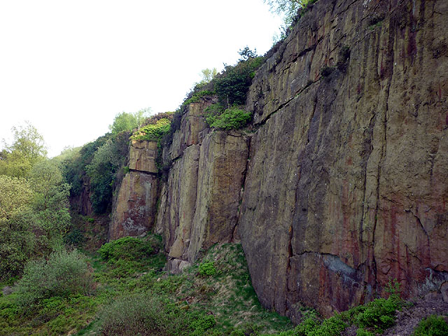
The east end of Wilton One (Horrocks Fold) Quarry
If you mention Horrocks Fold to a rock climber you will get a blank stare. All climbers refer to these quarries as Wilton, and this is the biggest (and best), Wilton One. This shows the far end which is less popular and hence tends to get overgrown and dirty. The BMC (British Mountaineering Council Link ) has recently purchased this quarry and has access arrangements with the owners and users of the other three. There are regular work parties which clear vegetation, clean the rock faces and pick up litter - unfortunately the quarries also attract a local 'chav' element.
 Map © Crown Copyright")
TIP: Click the map for more Large scale mapping
- Grid Square
- SD7013, 45 images (more nearby 🔍)
- Photographer
- Karl and Ali (more nearby)
- Date Taken
- Thursday, 21 April, 2011 (more nearby)
- Submitted
- Friday, 22 April, 2011
- Subject Location
-
OSGB36:
 SD 701 132 [100m precision]
WGS84: 53:36.8801N 2:27.1883W - Camera Location
-
OSGB36: SD 700 132
- View Direction
- East-southeast (about 112 degrees)