2011
TQ4501 : Cycle track alongside the A259
taken 13 years ago, near to Denton, East Sussex, England
This is 1 of 2 images, with title Cycle track alongside the A259 in this square
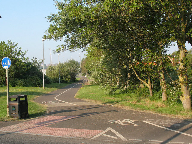
Cycle track alongside the A259
This segregated cycle track forms part of National Cycle Route 2,
National Cycle Network Route 2
National Route 2 will link Dover with St. Austell when complete via the south coast of England and is sometimes referred to as the South Coast Cycle Route.
The route is only fully open, at present, and signed between Dover and Brighton, but is still under development between Brighton and St. Austell.
 Map © Crown Copyright")
TIP: Click the map for more Large scale mapping
- Grid Square
- TQ4501, 85 images (more nearby 🔍)
- Photographer
- Stephen Craven (more nearby)
- Date Taken
- Sunday, 24 April, 2011 (more nearby)
- Submitted
- Wednesday, 27 April, 2011
- Subject Location
-
OSGB36:
 TQ 4543 0195 [10m precision]
WGS84: 50:47.9322N 0:3.7381E - Camera Location
-
OSGB36: TQ 4544 0196
- View Direction
- Southwest (about 225 degrees)