2011
NY3707 : Approaching Low Pike
taken 13 years ago, near to Rydal, Cumbria, England
This is 1 of 3 images, with title Approaching Low Pike in this square
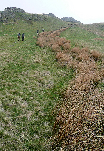
Approaching Low Pike
The path climbs steadily upwards. The craggy Low Pike, ahead, is the first peak on the south-eastern ridge of Fairfield, reached when walking the Fairfield Horseshoe in an anti-clockwise direction.
 Map © Crown Copyright")
TIP: Click the map for more Large scale mapping
- Grid Square
- NY3707, 78 images (more nearby 🔍)
- Photographer
- Graham Horn (more nearby)
- Date Taken
- Saturday, 23 April, 2011 (more nearby)
- Submitted
- Thursday, 28 April, 2011
- Subject Location
-
OSGB36:
 NY 373 075 [100m precision]
WGS84: 54:27.5726N 2:58.0392W - Camera Location
-
OSGB36: NY 374 075
- View Direction
- NORTH (about 0 degrees)