2011
SH6815 : Hafod Dywyll Farm
taken 13 years ago, near to Abergwynant, Gwynedd, Wales
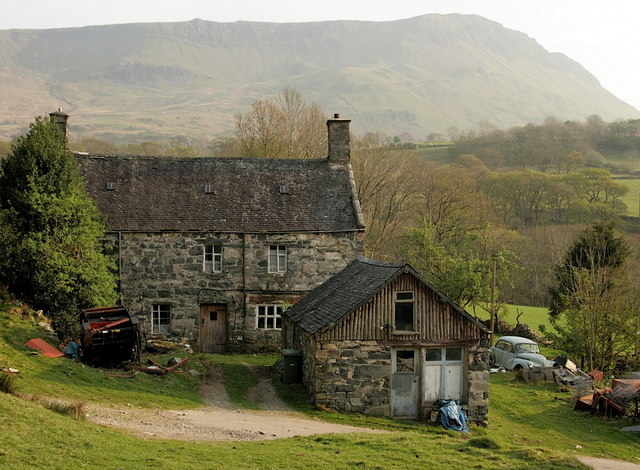
Hafod Dywyll Farm
With the western flank of Cadair Idris beyond. There is a much newer single-storey farmhouse a few yards away, and it is unclear whether this fine stone building is still occupied. Perhaps the wheelie bin suggests it is.
It has been many years, though, since the Morris visible to the right was occupied with anything other than gradual decay.
It has been many years, though, since the Morris visible to the right was occupied with anything other than gradual decay.
 Map © Crown Copyright")
TIP: Click the map for more Large scale mapping
- Grid Square
- SH6815, 52 images (more nearby 🔍)
- Photographer
- Hugh Chevallier (more nearby)
- Date Taken
- Saturday, 23 April, 2011 (more nearby)
- Submitted
- Thursday, 28 April, 2011
- Subject Location
-
OSGB36:
 SH 685 159 [100m precision]
WGS84: 52:43.5002N 3:56.8443W - Camera Location
-
OSGB36: SH 685 159
- View Direction
- South-southeast (about 157 degrees)