1989
HT9541 : Gaada Stack from Hamnafield, Foula
taken 35 years ago, near to Harrier, Foula, Shetland Islands, Scotland
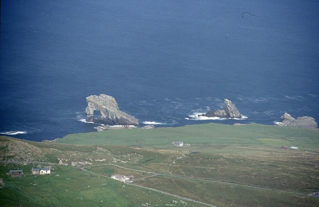
Gaada Stack from Hamnafield, Foula
The house on the left is North Harrier and further back towards the coast is Ristie.
 Map © Crown Copyright")
TIP: Click the map for more Large scale mapping
- Grid Square
- HT9541, 72 images (more nearby 🔍)
- Photographer
- Mike Pennington (more nearby)
- Date Taken
- Saturday, 19 August, 1989 (more nearby)
- Submitted
- Monday, 2 May, 2011
- Subject Location
-
OSGB36:
 HT 958 415 [100m precision]
WGS84: 60:9.4772N 2:4.6370W - Camera Location
-
OSGB36: HT 958 391
- View Direction
- NORTH (about 0 degrees)