2011
TQ3567 : Tramlink tram, South Norwood Country Park
taken 13 years ago, near to South Norwood, Croydon, England
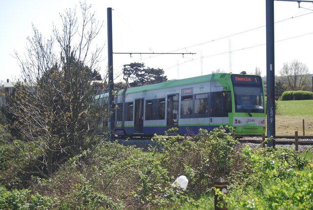
Tramlink tram, South Norwood Country Park
South Norwood Country Park :: TQ3568
South Norwood Country Park is a park, close to Elmers End station, mostly in the London Borough of Croydon. It is a 47 hectare green space which opened in 1989. The park occupies a mix of countryside and parkland, and land formerly used for sewage farms.
Wikipedia: Link
Tramlink
Tramlink is a tramway operating between Wimbledon and Beckenham Junction in South London. The system is centred around Croydon. It opened in 2000. Tramlink runs on a mixture of street track shared with other traffic, dedicated track in public roads, off-street track, and former railway lines.
Wikipedia: Link
Website: Link
Link
 Map © Crown Copyright")
TIP: Click the map for more Large scale mapping
- Grid Square
- TQ3567, 117 images (more nearby 🔍)
- Photographer
- N Chadwick (more nearby)
- Date Taken
- Saturday, 9 April, 2011 (more nearby)
- Submitted
- Friday, 13 May, 2011
- Subject Location
-
OSGB36:
 TQ 350 679 [100m precision]
WGS84: 51:23.6659N 0:3.6142W - Camera Location
-
OSGB36: TQ 350 679
- View Direction
- South-southeast (about 157 degrees)