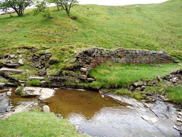
NY9039 : Remains of dam on Middlehope Burn above Low Slitt Mine
taken 13 years ago, near to Westgate, County Durham, England
The North Pennines Area of Outstanding Natural Beauty (AONB) became the first area in Britain to be awarded the status of European Geopark in June 2003 and was a founding member of the Global Geoparks Network in 2004.
Link
The three mile Geotrail from Westgate north along the Middlehope Burn including the lead mining area of Slitt Wood and West Rigg Opencut.
An audio-visual guide can be downloaded here:
Link
In 1997, Low Slitt became a scheduled monument protected by law and classified as of national importance. In 2008, a partnership between the landowner, Natural England and English Heritage was formed to consolidate the site and preserve the remains.
West Rigg Open Cutting SSSI Link
English Heritage Scheduled Monument, Middlehope Shield and Low Slit lead mines and ore works (1015825): Link
 Map © Crown Copyright")
- Grid Square
- NY9039, 213 images (more nearby 🔍)
- Photographer
- Andrew Curtis (more nearby)
- Date Taken
- Friday, 13 May, 2011 (more nearby)
- Submitted
- Sunday, 15 May, 2011
- Subject Location
-
OSGB36:
 NY 9056 3929 [10m precision]
WGS84: 54:44.9085N 2:8.8904W - Camera Location
-
OSGB36: NY 9056 3930
- View Direction
- Southwest (about 225 degrees)