2011
NS3775 : The Shore Circular Path
taken 13 years ago, near to Dumbarton, West Dunbartonshire, Scotland
This is 1 of 10 images, with title The Shore Circular Path in this square
The Shore Circular Path
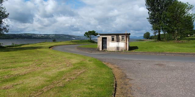
A signposted route called the Shore Circular Path leads through the photographer's position, and continues along the shore of the River Clyde (which is visible in the background).
The photograph was taken from the road junction that is shown in NS3775 : The former site of Havock Farm. The same area appears in another photograph: NS3775 : Pipeline on the shore.
The photograph was taken from the road junction that is shown in NS3775 : The former site of Havock Farm. The same area appears in another photograph: NS3775 : Pipeline on the shore.
 Map © Crown Copyright")
TIP: Click the map for more Large scale mapping
- Grid Square
- NS3775, 77 images (more nearby 🔍)
- Photographer
- Lairich Rig (more nearby)
- Date Taken
- Friday, 13 May, 2011 (more nearby)
- Submitted
- Wednesday, 18 May, 2011
- Subject Location
-
OSGB36:
 NS 3786 7538 [10m precision]
WGS84: 55:56.6417N 4:35.8691W - Camera Location
-
OSGB36: NS 3793 7538
- View Direction
- WEST (about 270 degrees)