2011
TQ3570 : Alexandra Recreation Ground
taken 13 years ago, near to Sydenham, Lewisham, England
This is 1 of 3 images, with title Alexandra Recreation Ground in this square
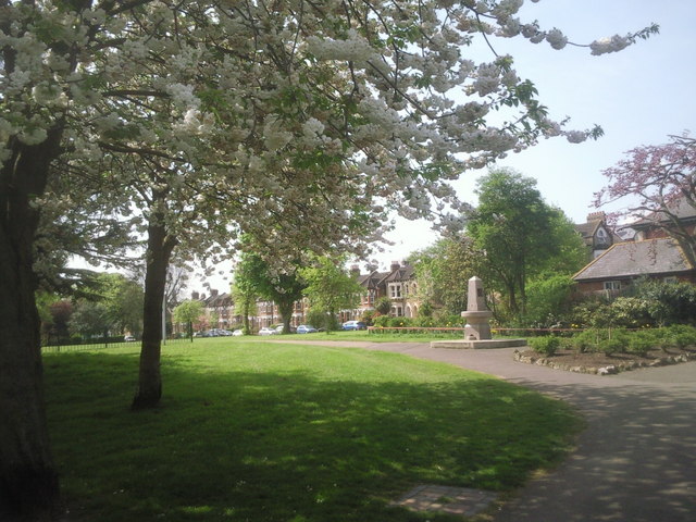
Alexandra Recreation Ground
Alexandra Recreation Ground was named after Queen Alexandra, King Edward VIIs wife, and was opened to the public in 1891 when she was Princess of Wales. Both the Green Chain Walk and the Capital Ring pass through it and anyone walking those routes will see the view here. The houses are in Maitland Road.
 Map © Crown Copyright")
TIP: Click the map for more Large scale mapping
- Grid Square
- TQ3570, 364 images (more nearby 🔍)
- Photographer
- Marathon (more nearby)
- Date Taken
- Saturday, 16 April, 2011 (more nearby)
- Submitted
- Thursday, 2 June, 2011
- Subject Location
-
OSGB36:
 TQ 3570 7087 [10m precision]
WGS84: 51:25.2364N 0:2.9868W - Camera Location
-
OSGB36: TQ 3572 7089
- View Direction
- Southwest (about 225 degrees)