2011
NN7528 : Tributary of Invergeldie Burn
taken 13 years ago, near to Invergeldie, Perth And Kinross, Scotland
Tributary of Invergeldie Burn
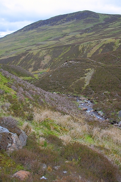
Looking towards Creag Tharsuinn (NN7429) with its muirburn noticeable.
Muirburn
Muirburn is the patchwork of heather resulting from the practice of controlled burning of the heather to create swathes of heathers of different ages. The burning encourages new growth which is an essential food for the grouse and provides cover for nesting. Burning is done under strict controls and on a rotational basis. Hill sheep also benefit from the burning.
In Yorkshire an area of burnt heather is called a 'swidden' or 'swizzen'.
 Map © Crown Copyright")
TIP: Click the map for more Large scale mapping
- Grid Square
- NN7528, 8 images (more nearby 🔍)
- Photographer
- Mick Garratt (more nearby)
- Date Taken
- Tuesday, 31 May, 2011 (more nearby)
- Submitted
- Friday, 3 June, 2011
- Subject Location
-
OSGB36:
 NN 7526 2898 [10m precision]
WGS84: 56:26.1877N 4:1.4779W - Camera Location
-
OSGB36: NN 7530 2896
- View Direction
- West-northwest (about 292 degrees)