2011
SK7423 : Holwell No. 1 quarry
taken 13 years ago, near to Holwell, Leicestershire, England
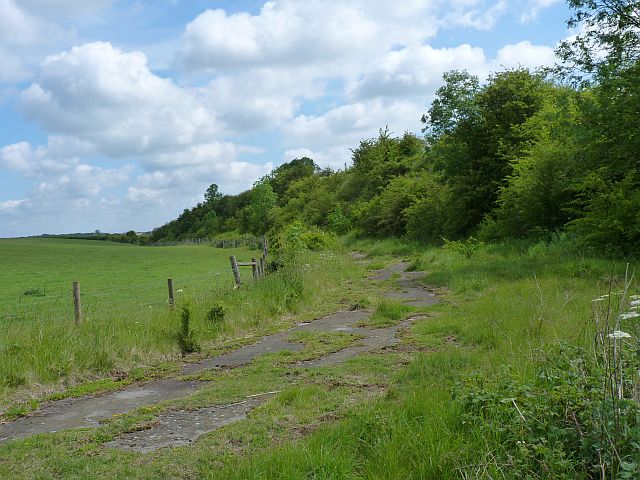
Holwell No. 1 quarry
The remains of No. 1 ironstone quarry, Holwell, worked from 1945 to 1962. The iron ore was taken to railway sidings at Holwell by lorry: the road for these was laid on top of the ironstone bed. The final face (on the right) of the overburden, known as the High Wall, was left in place at the request of the Leicestershire and Rutland Trust for Nature Conservation, as it is of interest to geologists as a unique Liassic section. The ground on the left of the road has been restored.
 Map © Crown Copyright")
TIP: Click the map for more Large scale mapping
- Grid Square
- SK7423, 41 images (more nearby 🔍)
- Photographer
- Richard Green (more nearby)
- Date Taken
- Thursday, 2 June, 2011 (more nearby)
- Submitted
- Friday, 3 June, 2011
- Subject Location
-
OSGB36:
 SK 7433 2385 [10m precision]
WGS84: 52:48.4253N 0:53.9271W - Camera Location
-
OSGB36: SK 7420 2370
- View Direction
- Northeast (about 45 degrees)