2011
TL4055 : Barton: The village pond
taken 13 years ago, near to Barton, Cambridgeshire, England
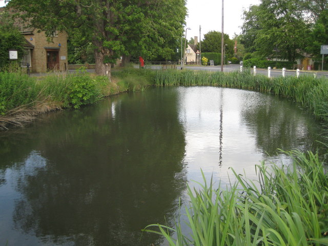
Barton: The village pond
The village pond is on the green on the north side of the B1046 Comberton Road. Unlike the nearby TL3856 : Comberton: The village pond the pond at Barton appears to be nearly full despite the long dry spring of 2011.
 Map © Crown Copyright")
TIP: Click the map for more Large scale mapping
- Grid Square
- TL4055, 155 images (more nearby 🔍)
- Photographer
- Nigel Cox (more nearby)
- Date Taken
- Saturday, 28 May, 2011 (more nearby)
- Submitted
- Sunday, 5 June, 2011
- Subject Location
-
OSGB36:
 TL 4063 5578 [10m precision]
WGS84: 52:10.9410N 0:3.3294E - Camera Location
-
OSGB36: TL 4061 5578
- View Direction
- EAST (about 90 degrees)