2011
J4842 : Downpatrick Racecourse from the Vianstown Road
taken 13 years ago, near to Downpatrick, Co Down, Northern Ireland
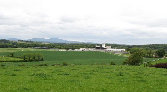
Downpatrick Racecourse from the Vianstown Road
The course is bisected by the Easting 48. The background is formed by the Slieve Croob range. Downpatrick Racecourse, whose history dates back to the 1685, is one of two Northern Irish racecourses, the other is The Down Royal at Lisburn.
Loading map... (JavaScript required)
- Grid Square
- J4842, 17 images (more nearby 🔍)
- Photographer
- Eric Jones (more nearby)
- Date Taken
- Monday, 6 June, 2011 (more nearby)
- Submitted
- Monday, 6 June, 2011
- Subject Location
-
Irish:
 J 480 429 [100m precision]
WGS84: 54:18.8045N 5:43.5954W - Camera Location
-
Irish: J 483 429
- View Direction
- WEST (about 270 degrees)