2011
SN1232 : Possible huts/shelters on Carn Bica
taken 13 years ago, 3 km from Mynachlog-Ddu, Pembrokeshire/Sir Benfro, Wales
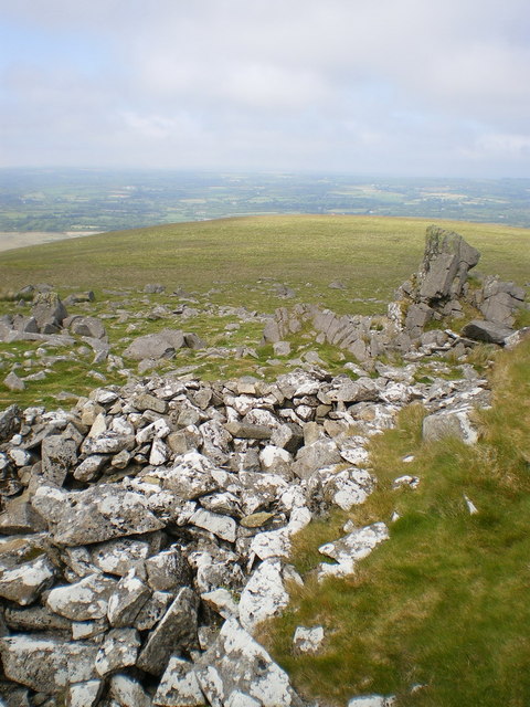
Possible huts/shelters on Carn Bica
Immediately below the summit rocks, a number of boulders of various sizes have been formed into low circular walls - a couple of these are visible in the foreground, and there are about 5 or 6 of them in total. Their age is completely indeterminate, and the Coflein database makes no mention of them.
 Map © Crown Copyright")
TIP: Click the map for more Large scale mapping
- Grid Square
- SN1232, 40 images (more nearby 🔍)
- Photographer
- Richard Law (more nearby)
- Date Taken
- Thursday, 2 June, 2011 (more nearby)
- Submitted
- Tuesday, 7 June, 2011
- Subject Location
-
OSGB36:
 SN 1291 3255 [10m precision]
WGS84: 51:57.5923N 4:43.4636W - Camera Location
-
OSGB36: SN 1290 3253
- View Direction
- North-northeast (about 22 degrees)