2011
NZ2115 : Pierce Bridge, Piercebridge
taken 13 years ago, near to Piercebridge, Darlington, England
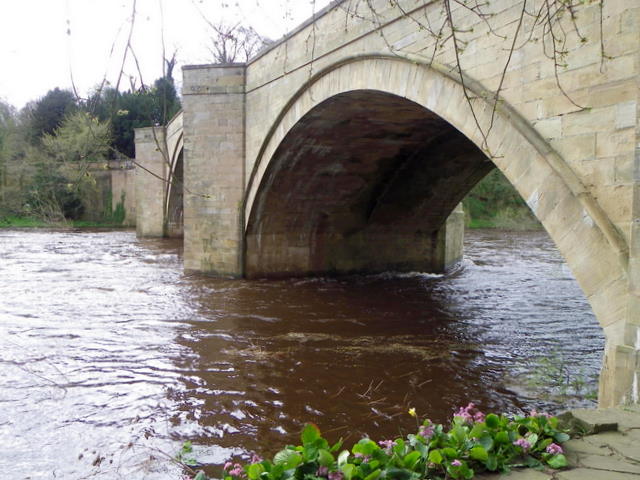
Pierce Bridge, Piercebridge
The bridge dates from the 16th century. This side of the bridge (downstream) was widened in the 1781. It is built of sandstone.
 Map © Crown Copyright")
TIP: Click the map for more Large scale mapping
- Grid Square
- NZ2115, 146 images (more nearby 🔍)
- Photographer
- Maigheach-gheal (more nearby)
- Date Taken
- Tuesday, 5 April, 2011 (more nearby)
- Submitted
- Tuesday, 7 June, 2011
- Subject Location
-
OSGB36:
 NZ 2107 1556 [10m precision]
WGS84: 54:32.0927N 1:40.5538W - Camera Location
-
OSGB36: NZ 21074 15590
- View Direction
- SOUTH (about 180 degrees)