1991
V5659 : Butter Road, above Caherdaniel
taken 33 years ago, near to Caherdaniel, Co Kerry, Ireland
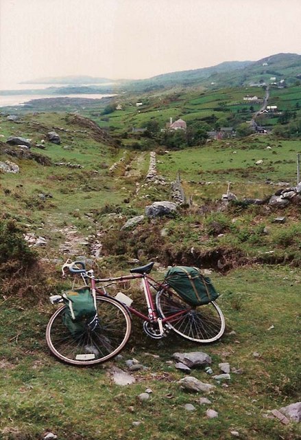
Butter Road, above Caherdaniel
Looking down the steep incline of the Butter Road towards Caherdaniel village
Loading map... (JavaScript required)
- Grid Square
- V5659 (more nearby 🔍)
- Photographer
- Martin Creek (more nearby)
- Date Taken
- Sunday, 19 May, 1991 (more nearby)
- Submitted
- Tuesday, 26 September, 2006
- Subject Location
-
Irish:
 V 56 59 [1000m precision]
WGS84: 51:46.1987N 10:4.7748W - View Direction
- WEST (about 270 degrees)