2011
TQ5538 : Rail underpass
taken 13 years ago, near to Langton Green, Kent, England
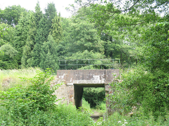
Rail underpass
This bridge carries the Spa Valley Railway over a bridleway.
Spa Valley Railway
The Spa Valley Railway is a heritage railway opened in 1996. Running for 4 miles from Tunbridge Wells to Eridge, with Groombridge and High Rocks stations mid point. The line originally connected to the London, Brighton and South Coast Railway lines until it finally closed in May 1985 but in March 2011 the line was reconnected to Eridge and the main line to London.
Some of the original station buildings have now been converted to other uses, Tunbridge Wells a restaurant and Groombridge to offices.
 Map © Crown Copyright")
TIP: Click the map for more Large scale mapping
- Grid Square
- TQ5538, 256 images (more nearby 🔍)
- Photographer
- Stephen Craven (more nearby)
- Date Taken
- Friday, 24 June, 2011 (more nearby)
- Submitted
- Saturday, 9 July, 2011
- Subject Location
-
OSGB36:
 TQ 5572 3821 [10m precision]
WGS84: 51:7.3210N 0:13.4226E - Camera Location
-
OSGB36: TQ 5570 3823
- View Direction
- Southeast (about 135 degrees)