2011
SK3068 : Strange Stone
taken 13 years ago, near to Wadshelf, Derbyshire, England
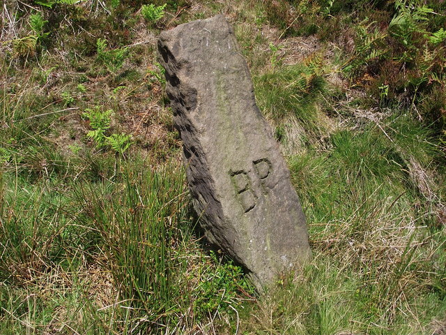
Strange Stone
Initialled stone situated North-East of the Hipper Sick, just after it has passed under the road. Could be a Boundary of Parish or Boundary Pillar (hence 'BP'), that point became a boundary edge in 1935 for Walton (now Holymoorside & Walton)
 Map © Crown Copyright")
TIP: Click the map for more Large scale mapping
- Grid Square
- SK3068, 26 images (more nearby 🔍)
- Photographer
- Tony Bacon (more nearby)
- Date Taken
- Sunday, 10 July, 2011 (more nearby)
- Submitted
- Tuesday, 12 July, 2011
- Subject Location
-
OSGB36:
 SK 3089 6872 [10m precision]
WGS84: 53:12.8788N 1:32.3331W - Camera Location
-
OSGB36: SK 3089 6871
- View Direction
- Northeast (about 45 degrees)