2010
TM2863 : Wall of the Inner Court of Framlingham Castle
taken 14 years ago, near to Framlingham, Suffolk, England
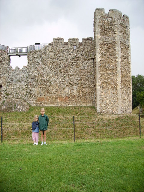
Wall of the Inner Court of Framlingham Castle
Framlingham Castle has 12 hollow towers (a 13th collapsed) connected by a large curtain wall, 13m high and 2.5m thick. The wall walk along the top is open to visitors.
Roger Bigod built the castle, between 1189 and 1200, to replace his father's castle, which Henry II had destroyed in 1175. The castle never had a keep, instead relying on the defensive strength of its walls, towers and surrounding earthworks. If attackers managed to scale the wall, the planks spanning the hollow towers could be removed, isolating that section of wall.
In 1553, King Edward VI gave Framlingham Castle to his sister Mary, and it was at this castle, a few months later, that she learnt she had been made queen. Mary's successor, Queen Elizabeth, used the castle as a prison for priests who defied the new Church of England.
The castle courtyard once contained a number of stone buildings, including a great hall, but this was demolished in order to build a workhouse in 1664, and the other buildings were pulled down in 1688. The castle still contains a poorhouse built in 1729, which now houses the visitor centre.
(Source: Link (Archive Link )
Roger Bigod built the castle, between 1189 and 1200, to replace his father's castle, which Henry II had destroyed in 1175. The castle never had a keep, instead relying on the defensive strength of its walls, towers and surrounding earthworks. If attackers managed to scale the wall, the planks spanning the hollow towers could be removed, isolating that section of wall.
In 1553, King Edward VI gave Framlingham Castle to his sister Mary, and it was at this castle, a few months later, that she learnt she had been made queen. Mary's successor, Queen Elizabeth, used the castle as a prison for priests who defied the new Church of England.
The castle courtyard once contained a number of stone buildings, including a great hall, but this was demolished in order to build a workhouse in 1664, and the other buildings were pulled down in 1688. The castle still contains a poorhouse built in 1729, which now houses the visitor centre.
(Source: Link
 Map © Crown Copyright")
TIP: Click the map for more Large scale mapping
- Grid Square
- TM2863, 793 images (more nearby 🔍)
- Photographer
- Helen Steed (more nearby)
- Date Taken
- Monday, 26 July, 2010 (more nearby)
- Submitted
- Thursday, 14 July, 2011
- Subject Location
-
OSGB36:
 TM 2870 6367 [10m precision]
WGS84: 52:13.4233N 1:20.8222E - Camera Location
-
OSGB36: TM 2871 6364
- View Direction
- North-northwest (about 337 degrees)