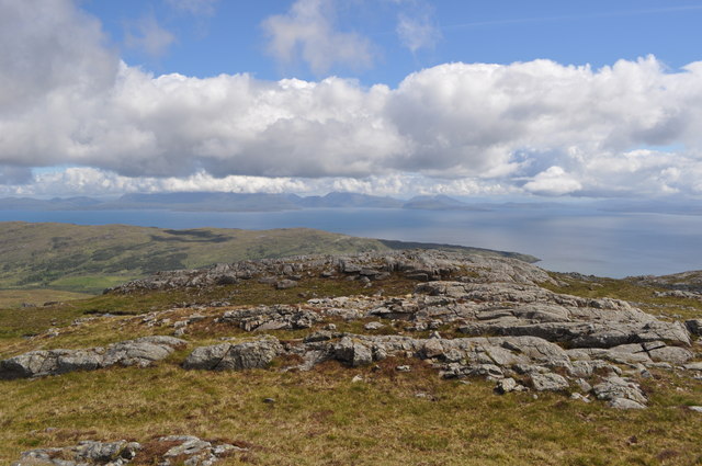
NM3997 : Cnapan Breaca
taken 13 years ago, near to Kinloch, Rum, Scotland
The Northern Marginal Zone is an area of geology formed in stage 1 of the Rum volcanic complex. The Isle of Rum sits on a ridge of Gneiss and Torridonian strata. Around 61 Ma the volcanic plume under Scotland formed starting off an intense period of volcanic activity. A large pulse of magma formed under Rùm causing a large dome to form. A ring fault formed bringing up Gneiss and basal Torridonian members up around 2km. This large dome later collapsed and formed a caldera, the eruption being enormous. The walls and roof debris formed the Coire Dubh Breccia. Clasts vary but they are made up of Gritty sandstone, Applecross, silts and rare Gneiss. The Caldera filled with ash flows (porphyritic rhyolite visible today), also of interest are some lake deposits. The area is intruded with many pale coloured dykes.
Stage 2 commenced with basaltic dykes being intruded before the layered Gabbro, troctolite and peridotite intrusion formed. Up to 16 pulses of magma meant crystal settling in this magma chamber giving us the gentle layers of Hallival and Askival. This intrusion borders the NMZ.
As you walk up the path from Kinloch the area of wood gives way to heath and bog. This is the in situ Applecross Torridonian strata, formed by rivers with large drainage basins. The rivers were in a sub tropical environment around 30-40N latitude.
Next is a series of silts and muds, the boundary being the outer ring fault. These silts belong to the Diabaig formation, older than the Applecross, they have been uplifted by the fault. These were formed in lakes at the bottom of palaeovalleys: rubidium to strontium dates give 944 Ma as a date. A further walk and the gritty sandstone is visible. Clear cross lamination is visible in some parts, the boundary, behind the dam is the inner ring fault. The gorge here was cut by the river along the weaker (chemically) basaltic dyke. The coire is made up of breccia capped with porphyritic rhyolite as mentioned earlier. There are also several plugs. Nearer the Eastern layered intrusion is an area of intrusive gabbrotic breccia and marginal dolerite/gabbro. An interesting feature near Cnapan Breaca is a large gabbro finger.
Sources: Geological History of Great Britain and Ireland by Nigel Woodcock and Rob Strachan, A geological excursion to Rum by VR Troll and CH Emeleus.
 Map © Crown Copyright")
- Grid Square
- NM3997, 35 images (more nearby 🔍)
- Photographer
- Ashley Dace (more nearby)
- Date Taken
- Tuesday, 14 June, 2011 (more nearby)
- Submitted
- Friday, 15 July, 2011
- Subject Location
-
OSGB36:
 NM 3934 9749 [10m precision]
WGS84: 56:59.6869N 6:17.6030W - Camera Location
-
OSGB36: NM 3930 9745
- View Direction
- Northeast (about 45 degrees)