2011
TQ3961 : Coal tax post, King Henry's Drive
taken 13 years ago, near to New Addington, Croydon, England
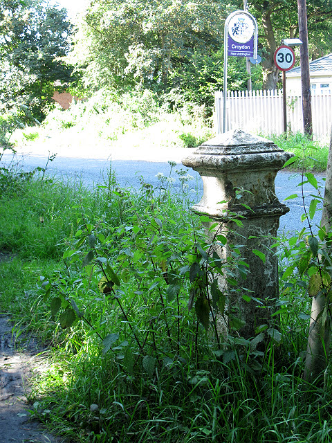
Coal tax post, King Henry's Drive
This unassuming post marks quite a historical location. Not only is it on the present boundary of Greater London (as the "welcome to Croydon" sign in the background shows): the coal tax post also indicates a historic boundary (see shared description) and the map indicates a Roman road crossing the present road at this point.
Coal Tax Posts
Coal Tax Posts were markers defining the area within which the Corporation of London could charge duty on coal entering the area. This area had been expanded in 1851 but then reduced in 1861 to coincide with the Metropolitan Police District of the day, the limits of which were between about 20 km and 30km from Charing Cross. It is from this latter time that most of the existing posts date. See Link
for further background, with much more comprehensive information at Martin Nail's excellent site, Link
 Map © Crown Copyright")
TIP: Click the map for more Large scale mapping
- Grid Square
- TQ3961, 55 images (more nearby 🔍)
- Photographer
- Stephen Craven (more nearby)
- Date Taken
- Sunday, 24 July, 2011 (more nearby)
- Submitted
- Saturday, 30 July, 2011
- Subject Location
-
OSGB36:
 TQ 3949 6127 [10m precision]
WGS84: 51:20.0053N 0:0.0556E - Camera Location
-
OSGB36: TQ 3949 6127
- View Direction
- North-northwest (about 337 degrees)