2006
TQ8960 : Swale Ploughing Match
taken 18 years ago, near to Tunstall, Kent, England
Swale Ploughing Match
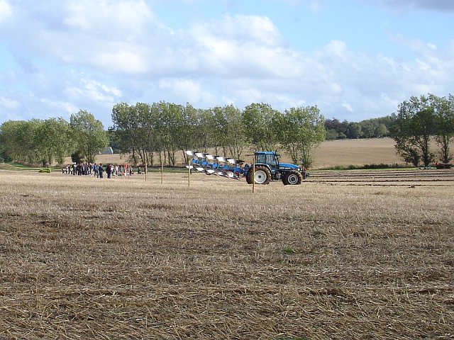
The weather was changeable, the field rather muddy and by the time the plough-off took place most people had gone home. I included this shot because it shows the curiously curved (and rather wobbly) field boundary, indicated by the line of trees. I assume the two fields belong to different farms. The match took place on Grove End Farm but the slate-roofed oast in the background is Oakwood Farm on Ruins Barn Road. For more pictures of the ploughing match see TQ8961
 Map © Crown Copyright")
TIP: Click the map for more Large scale mapping
- Grid Square
- TQ8960, 20 images (more nearby 🔍)
- Photographer
- Penny Mayes (more nearby)
- Date Taken
- Saturday, 30 September, 2006 (more nearby)
- Submitted
- Wednesday, 4 October, 2006
- Subject Location
-
OSGB36:
 TQ 890 609 [100m precision]
WGS84: 51:18.9487N 0:42.6409E - Camera Location
-
OSGB36: TQ 889 610
- View Direction
- East-southeast (about 112 degrees)