2011
SD7470 : The limestone upland of Clapdale Scars
taken 13 years ago, near to Clapham, North Yorkshire, England
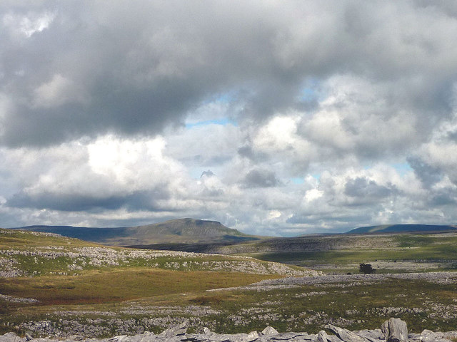
The limestone upland of Clapdale Scars
An area of scars, outcrops and rough grassland typical of many around the southern flanks of Ingleborough and Whernside. Penyghent and Fountains Fell on the skyline.
 Map © Crown Copyright")
TIP: Click the map for more Large scale mapping
- Grid Square
- SD7470, 27 images (more nearby 🔍)
- Photographer
- Karl and Ali (more nearby)
- Date Taken
- Sunday, 7 August, 2011 (more nearby)
- Submitted
- Wednesday, 10 August, 2011
- Subject Location
-
OSGB36:
 SD 7451 7091 [10m precision]
WGS84: 54:8.0039N 2:23.4959W - Camera Location
-
OSGB36: SD 7425 7089
- View Direction
- EAST (about 90 degrees)