2011
NT2540 : Flooding at Cuddyside, Peebles
taken 13 years ago, near to Peebles, Scottish Borders, Scotland
This is 1 of 2 images, with title Flooding at Cuddyside, Peebles in this square
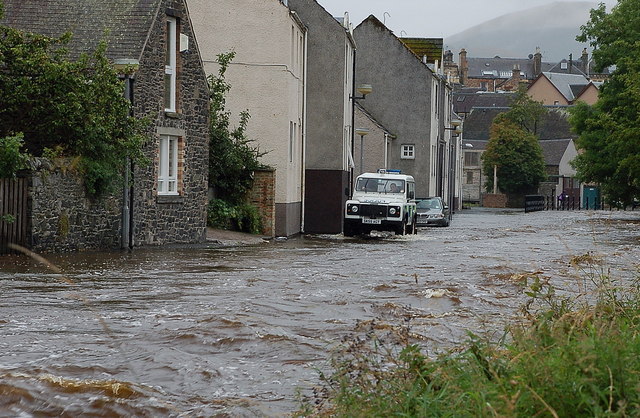
Flooding at Cuddyside, Peebles
The Eddleston Water or Cuddy has risen after almost 36 hours of rain, and the Police Landrover is checking the situation. See NT2540 : Cuddyside, Peebles for a view from the opposite bank in normal conditions.
 Map © Crown Copyright")
TIP: Click the map for more Large scale mapping
- Grid Square
- NT2540, 1180 images (more nearby 🔍)
- Photographer
- Jim Barton (more nearby)
- Date Taken
- Thursday, 11 August, 2011 (more nearby)
- Submitted
- Saturday, 13 August, 2011
- Subject Location
-
OSGB36:
 NT 2520 4078 [10m precision]
WGS84: 55:39.2859N 3:11.4192W - Camera Location
-
OSGB36: NT 2518 4080
- View Direction
- Southeast (about 135 degrees)