TQ2636 : St. John the Baptist, Crawley: churchyard (3)
taken 13 years ago, near to Crawley, West Sussex, England
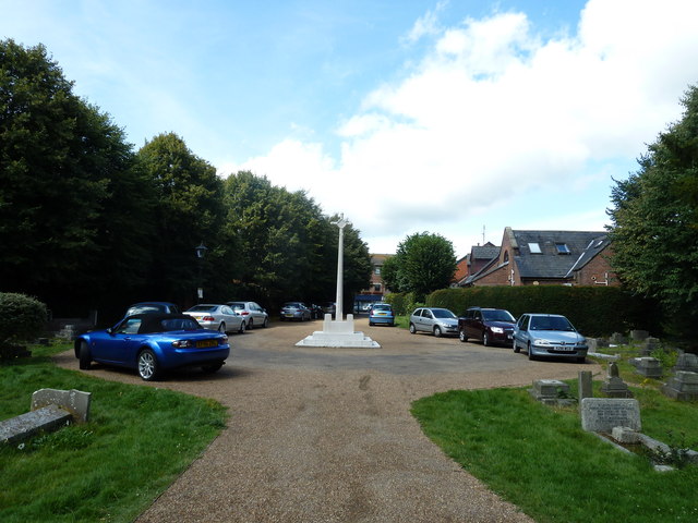
The Cross of Sacrifice or War Cross is a feature in most cemeteries with 50 or more war graves. It was designed by Sir Reginald Blomfield (Link
Wikipedia) for the Imperial War Graves Commission (now Commonwealth War Graves Commission Link
The monument is normally a tall, freestanding, carefully proportioned four-point limestone Latin cross standing on an octagonal base. Depending upon the size of the cemetery, it can range in height from 18 to 32 feet (4.5 to 9 metres). A downward-pointing bronze broadsword is depicted on the face of the cross. Together, the sword and cross embody the military and spiritual nature of the cemetery; the cross symbolises the faith of the majority of the war dead and the sword represents the military character of the cemetery.
There are many of them in war cemeteries in France and the Commonwealth and also around this country including Peel Green Cemetery at Salford SJ7497 : Peel Green Cemetery War Memorial (Cross of Sacrifice), Leigh Cemetery SJ6899 : Leigh Cemetery War Memorial (Cross of Sacrifice), Newark-on-Trent Cemetery SK8052 : Newark-on-Trent Cemetery, Cross of Sacrifice, Widnes Cemetery SJ5187 : Widnes Cemetery, Cross of Sacrifice and others.
Most of the memorials have this inscription on the base:
THIS CROSS OF SACRIFICE IS ONE IN DESIGN
AND INTENTION WITH THOSE WHICH HAVE
BEEN SET UP IN FRANCE AND BELGIUM AND
OTHER PLACES THROUGHOUT THE WORLD
WHERE OUR DEAD OF THE
GREAT WAR ARE LAID TO REST,
THEIR NAME LIVETH FOR EVERMORE
SJ6899 : Cross of Sacrifice - Base
 Map © Crown Copyright")
- Grid Square
- TQ2636, 503 images (more nearby 🔍)
- Photographer
- Basher Eyre (more nearby)
- Date Taken
- Saturday, 13 August, 2011 (more nearby)
- Submitted
- Saturday, 13 August, 2011
- Subject Location
-
OSGB36:
 TQ 2686 3654 [10m precision]
WGS84: 51:6.8471N 0:11.3408W - Camera Location
-
OSGB36: TQ 2688 3654
- View Direction
- WEST (about 270 degrees)