2006
SD7476 : Middle Washfold
taken 18 years ago, near to Chapel-le-Dale, North Yorkshire, England
This is 1 of 5 images, with title Middle Washfold in this square
Middle Washfold
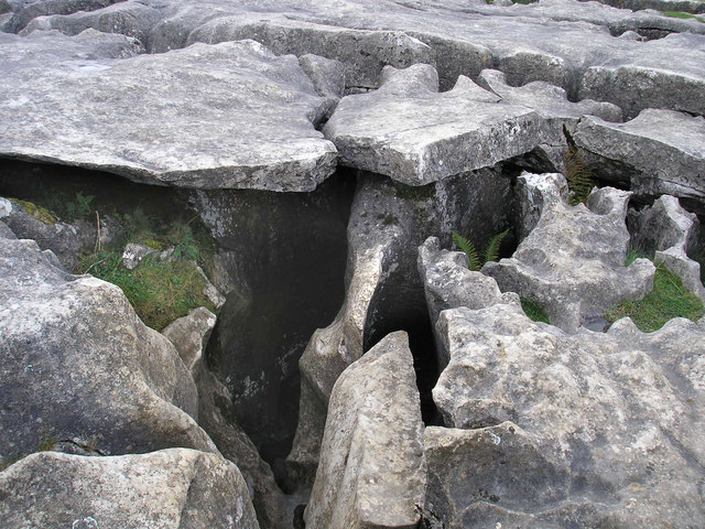
There are several caves and pothole entrances near here. The top layer of limestone pavement seems separate from the rock beneath which has eroded in a different way.
 Map © Crown Copyright")
TIP: Click the map for more Large scale mapping
- Grid Square
- SD7476, 56 images (more nearby 🔍)
- Photographer
- John Illingworth (more nearby)
- Date Taken
- Saturday, 7 October, 2006 (more nearby)
- Submitted
- Sunday, 8 October, 2006
- Subject Location
-
OSGB36:
 SD 747 764 [100m precision]
WGS84: 54:10.9648N 2:23.3493W - View Direction
- WEST (about 270 degrees)