2011
TQ1312 : Looking out from Chanctonbury Ring
taken 13 years ago, near to Washington, West Sussex, England
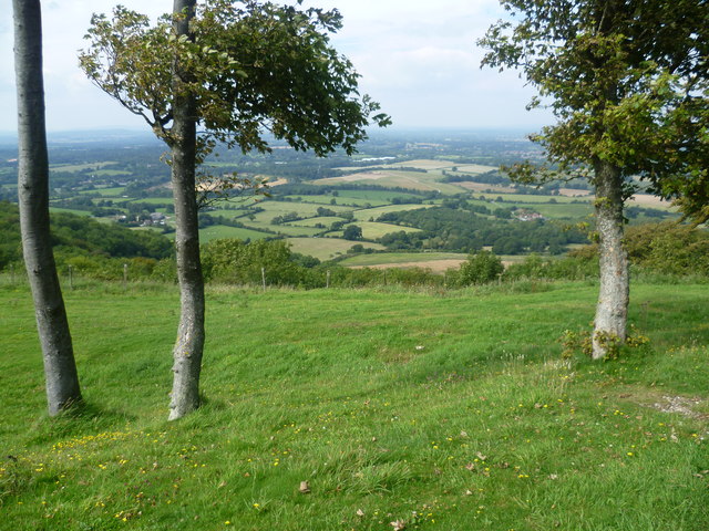
Looking out from Chanctonbury Ring
Chanctonbury Ring was originally a small hill fort in a commanding position dating from the 6th to 5th centuries BC - the early Iron Age. The beech trees, were planted in 1760 by Charles Goring within the earth bank of the fort. As the trees grew rapidly, they became a prominent landmark. However, the Great Storm of 1987 destroyed most of the trees and the replanted trees are only now beginning to mature and restore Chanctonbury Ring to what it was before. This view is from the edge of the Ring looking down the South Downs scarp and across the Weald.
 Map © Crown Copyright")
TIP: Click the map for more Large scale mapping
- Grid Square
- TQ1312, 108 images (more nearby 🔍)
- Photographer
- Marathon (more nearby)
- Date Taken
- Friday, 19 August, 2011 (more nearby)
- Submitted
- Saturday, 20 August, 2011
- Subject Location
-
OSGB36:
 TQ 1381 1208 [10m precision]
WGS84: 50:53.8197N 0:22.9816W - Camera Location
-
OSGB36: TQ 1385 1204
- View Direction
- Northwest (about 315 degrees)