2011
NY8128 : River Tees from hillside above Cauldron Snout
taken 13 years ago, 5 km SW of Langdon Beck, County Durham, England
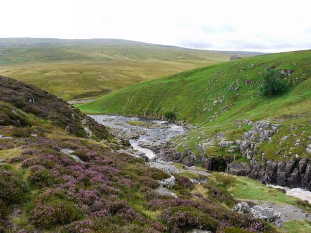
River Tees from hillside above Cauldron Snout
View of the river at the bottom of the waterfall, its junction with Maize Beck, and south to Mickle Fell.
Widdybank Fell Nature Trail :: NY8130
The walk starts at Cow Green car park and takes you over Widdybank Fell along the tarmac track to Cow Green dam and Cauldron Snout waterfall, returning the same way.
A copy of the walk leaflet can be obtained from:
Natural England - Moor House - Upper Teesdale NNR: Link
There is also a geological trail leaflet here Link
 Map © Crown Copyright")
TIP: Click the map for more Large scale mapping
- Grid Square
- NY8128, 129 images (more nearby 🔍)
- Photographer
- Andrew Curtis (more nearby)
- Date Taken
- Friday, 19 August, 2011 (more nearby)
- Submitted
- Saturday, 20 August, 2011
- Subject Location
-
OSGB36:
 NY 8143 2852 [10m precision]
WGS84: 54:39.0861N 2:17.3591W - Camera Location
-
OSGB36: NY 8146 2870
- View Direction
- SOUTH (about 180 degrees)