2009
SD8271 : A pothole and a view to Pen-y-ghent
taken 15 years ago, near to Studfold, North Yorkshire, England
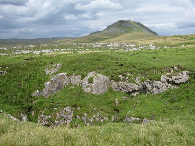
A pothole and a view to Pen-y-ghent
Looking towards Pen-y-ghent from a pothole on the west side of Long Lane. In between there is an area of limestone pavement.
 Map © Crown Copyright")
TIP: Click the map for more Large scale mapping
- Grid Square
- SD8271, 42 images (more nearby 🔍)
- Photographer
- John S Turner (more nearby)
- Date Taken
- Friday, 31 July, 2009 (more nearby)
- Submitted
- Monday, 22 August, 2011
- Subject Location
-
OSGB36:
 SD 8289 7153 [10m precision]
WGS84: 54:8.3592N 2:15.8032W - Camera Location
-
OSGB36: SD 8284 7141
- View Direction
- North-northeast (about 22 degrees)