2011
SO7377 : The Elan Valley pipeline in the Wyre Forest
taken 13 years ago, near to Buttonoak, Shropshire, England
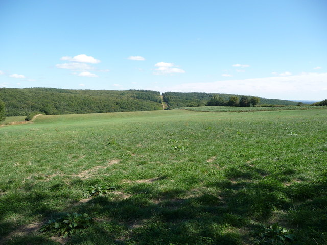
The Elan Valley pipeline in the Wyre Forest
The break in the plantation shows the line of the water pipeline from near Winwoods Farm.
 Map © Crown Copyright")
TIP: Click the map for more Large scale mapping
- Grid Square
- SO7377, 27 images (more nearby 🔍)
- Photographer
- Jeremy Bolwell (more nearby)
- Date Taken
- Sunday, 21 August, 2011 (more nearby)
- Submitted
- Monday, 22 August, 2011
- Subject Location
-
OSGB36:
 SO 7365 7763 [10m precision]
WGS84: 52:23.7629N 2:23.3202W - Camera Location
-
OSGB36: SO 7303 7751
- View Direction
- East-northeast (about 67 degrees)