2011
SP2282 : A452 Kenilworth Road crosses the river Blythe
taken 13 years ago, near to Meriden, Solihull, England
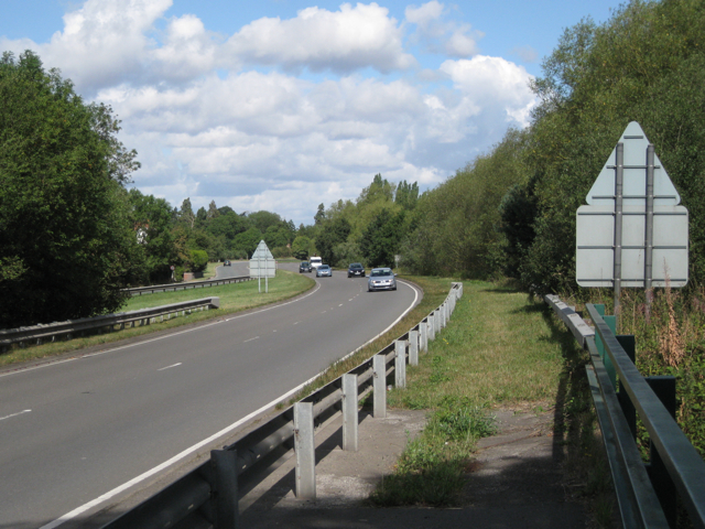
A452 Kenilworth Road crosses the river Blythe
The A452 racetrack snakes towards Stonebridge, the junction with the A45. This is the southbound carriageway photographed from the modern bridge, Molands Bridge (New). It is not shown on OS maps until 1983 although it is more likely to have been built in the 1970s. The crash barriers were installed between 2006 and 2008 as a precaution against vehicles colliding with the parapet fence in an accident. The northbound carriageway crosses the river by the original Molands Bridge, out of shot, left: SP2282 : Molands Bridge (Old)
 Map © Crown Copyright")
TIP: Click the map for more Large scale mapping
- Grid Square
- SP2282, 20 images (more nearby 🔍)
- Photographer
- Robin Stott (more nearby)
- Date Taken
- Monday, 15 August, 2011 (more nearby)
- Submitted
- Monday, 29 August, 2011
- Subject Location
-
OSGB36:
 SP 2202 8212 [10m precision]
WGS84: 52:26.1968N 1:40.6512W - Camera Location
-
OSGB36: SP 2205 8208
- View Direction
- Northwest (about 315 degrees)