2011
NR7993 : The end of the road at Crinan Ferry
taken 13 years ago, near to Kilmahumaig, Argyll And Bute, Scotland
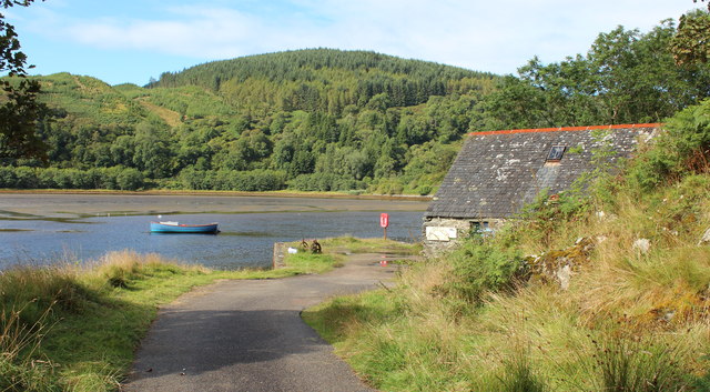
The end of the road at Crinan Ferry
Looking over the Add estuary.
The Boat House Gallery is on the right.
The Boat House Gallery is on the right.
 Map © Crown Copyright")
TIP: Click the map for more Large scale mapping
- Grid Square
- NR7993, 115 images (more nearby 🔍)
- Photographer
- Bob Embleton (more nearby)
- Date Taken
- Monday, 15 August, 2011 (more nearby)
- Submitted
- Tuesday, 30 August, 2011
- Subject Location
-
OSGB36:
 NR 7956 9355 [10m precision]
WGS84: 56:5.0265N 5:32.6707W - Camera Location
-
OSGB36: NR 7962 9359
- View Direction
- Southwest (about 225 degrees)