2011
SY9592 : Former Naval checkpoint on Wareham Road
taken 13 years ago, near to Organford, Dorset, England
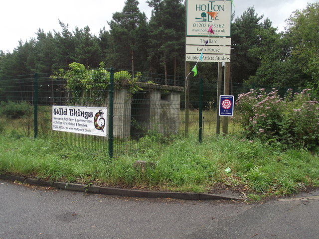
Former Naval checkpoint on Wareham Road
In 1915 the area in the background along with the industrial units close by were commissioned by the then War Office for the production of cordite.
The area is now secured and still controlled by the M.O.D. The fencing has warning notices relating to the danger of contamination and unsafe structures. Enter at your own risk.
The area is now secured and still controlled by the M.O.D. The fencing has warning notices relating to the danger of contamination and unsafe structures. Enter at your own risk.
 Map © Crown Copyright")
TIP: Click the map for more Large scale mapping
- Grid Square
- SY9592, 31 images (more nearby 🔍)
- Photographer
- Anthony Vosper (more nearby)
- Date Taken
- Friday, 26 August, 2011 (more nearby)
- Submitted
- Wednesday, 31 August, 2011
- Subject Location
-
OSGB36:
 SY 951 920 [100m precision]
WGS84: 50:43.6721N 2:4.2133W - Camera Location
-
OSGB36: SY 951 920
- View Direction
- South-southwest (about 202 degrees)