2011
TL1140 : Irrigation on Farmland Rowney Warren Woods
taken 13 years ago, near to Chicksands, Central Bedfordshire, England
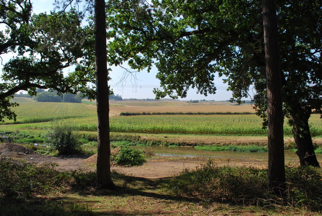
Irrigation on Farmland Rowney Warren Woods
This is the farmland to the South of Rowney Warren Woods. The man made bank in the distance is actually the wall of a reservoir which is used to water the crops. You can just about make out an orange life jacket on top of the bank.
 Map © Crown Copyright")
TIP: Click the map for more Large scale mapping
- Grid Square
- TL1140, 24 images (more nearby 🔍)
- Photographer
- Martin (more nearby)
- Date Taken
- Friday, 2 September, 2011 (more nearby)
- Submitted
- Friday, 2 September, 2011
- Subject Location
-
OSGB36:
 TL 1156 4009 [10m precision]
WGS84: 52:2.8791N 0:22.4775W - Camera Location
-
OSGB36: TL 11802 40329
- View Direction
- Southwest (about 225 degrees)