NZ0737 : Whitfield House, Front Street, Wolsingham
taken 13 years ago, near to Wolsingham, County Durham, England
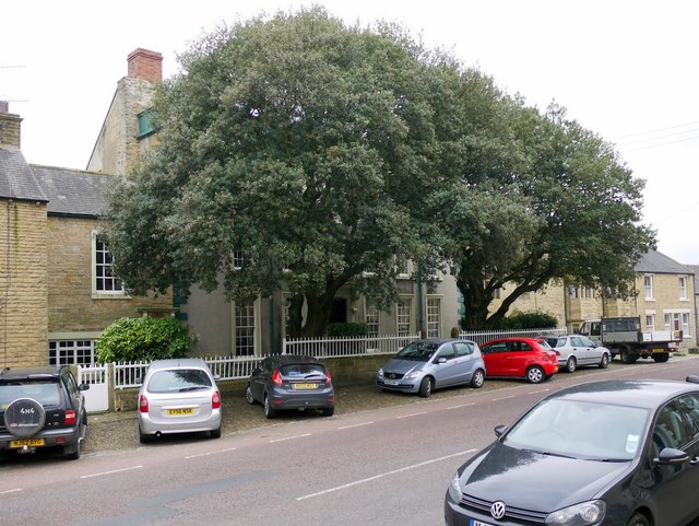
Whitfield House Cottage, a wing of the main house which dates from mid C18th can be seen on the left and is another listed building.
Whitfield House Cottage, Wolsingham (Wolsingham) Link
Wolsingham is a small market town in County Durham situated where the Waskerley Beck joins the River Wear. It styles itself as the 'Gateway to Weardale'. It is an interesting and friendly place, bustling with life, but with many old and interesting buildings. It now serves a predominantly agricultural community but once had a thriving and important steel works.
My descriptions have been aided by the local book: Wolsingham: Gateway to Weardale by Elaine Ridley, Margaret Shepheard and Vivien Welsh (ISBN 0 953074 97 B)
Wikipedia: Link
English Heritage learning zone: Wolsingham Link
Old photos of Wolsingham in Durham County Council collection: Link
Old photos of Wolsingham in the Beamish Museum People's Collection Link
Wolsingham website: Link
 Map © Crown Copyright")
- Grid Square
- NZ0737, 190 images (more nearby 🔍)
- Photographer
- Andrew Curtis (more nearby)
- Date Taken
- Friday, 2 September, 2011 (more nearby)
- Submitted
- Saturday, 3 September, 2011
- Subject Location
-
OSGB36:
 NZ 0744 3720 [10m precision]
WGS84: 54:43.7839N 1:53.1595W - Camera Location
-
OSGB36: NZ 0746 3722
- View Direction
- Southwest (about 225 degrees)