2011
SN0732 : Path to Bwlch-gwynt
taken 13 years ago, 3 km from Rosebush, Pembrokeshire/Sir Benfro, Wales
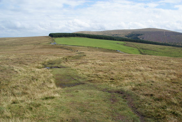
Path to Bwlch-gwynt
Bwlch-gwynt is a pass between Foel Eryr and the rest of the Preseli ridge. The path crosses a very damp section just before it reaches the road.
 Map © Crown Copyright")
TIP: Click the map for more Large scale mapping
- Grid Square
- SN0732, 42 images (more nearby 🔍)
- Photographer
- Bill Boaden (more nearby)
- Date Taken
- Wednesday, 24 August, 2011 (more nearby)
- Submitted
- Sunday, 4 September, 2011
- Subject Location
-
OSGB36:
 SN 0717 3212 [10m precision]
WGS84: 51:57.2429N 4:48.4552W - Camera Location
-
OSGB36: SN 0705 3212
- View Direction
- EAST (about 90 degrees)